
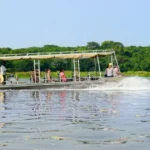
Lake Albert Delta
July 2, 2026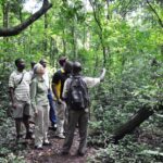
Rabongo Forest
July 2, 2026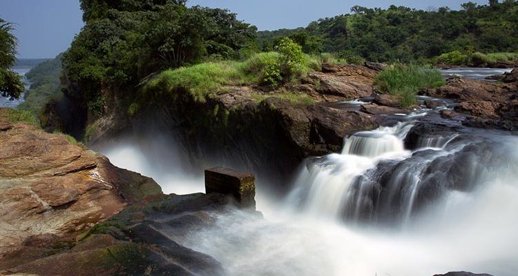
Murchison Falls
Murchison Falls are located 32 kilometers east of Lake Albert in northwestern Uganda, within the boundaries of Murchison Falls National Park but entirely worth treating as a destination in their own right. Most visitors arrive by boat on the Nile, which is the best way to approach.
The falls can also be reached by road and viewed from the top, which gives a different and, in some ways, more striking perspective. Both are worth doing if your schedule allows.
The falls have two names, and both carry weight. The local name is Kabalega Falls, after Omukama Chwa II Kabalega, the king of the Bunyoro Kingdom who controlled this stretch of the Nile in the 19th century and who resisted British colonial expansion until his capture and exile to the Seychelles in 1899.
The name Kabalega was not widely applied until Idi Amin’s government unofficially adopted it in the 1970s as part of a broader Africanization campaign, but it never replaced the earlier name in law. After Amin’s fall, the colonial name returned. Some Ugandans still use Kabalega today, and both names refer to the same place.
The name Murchison Falls was given by Samuel Baker in 1864. Baker and his wife Florence were the first Europeans documented to have seen the falls directly, having arrived at the Nile from the south during an expedition to trace the river’s sources.
Baker named the falls after Roderick Murchison, the geologist and then-president of the Royal Geographical Society in London, which had funded and supported several of the great Nile exploration expeditions of the era. Baker also named Lake Albert, the lake into which the Nile flows just downstream from the falls, after Queen Victoria’s husband Prince Albert.
John Hanning Speke and James Grant had come close to the falls in 1862 without seeing them directly. Speke visited Karuma Falls to the east and was told by locals that a larger waterfall lay further downriver.
He recorded in his notes that this fall was within earshot but did not travel to see it. Baker, who came two years later, was the one who stood at the edge of the gorge and recorded what he saw. His description, published on return to England, put Murchison Falls on the map for European audiences and sparked the interest that eventually led to the park being created around it.
Some historians have pointed to even earlier accounts. There is a contested theory that a group of Roman soldiers sent by Emperor Nero to explore the Nile may have reached the falls in 61 AD, though the evidence for this is thin and the claim remains disputed. Whether or not Roman soldiers ever stood at this gorge, the local Acholi, Alur, Jonam, and Bunyoro communities had known the falls for generations before any European expedition arrived. The Nile at this point was a significant boundary and landmark within the Bunyoro Kingdom.
Winston Churchill visited in 1907 during his famous African safari and hiked to the base of the falls. Ernest Hemingway, travelling with his wife Mary in January 1954, was on a sightseeing flight over the park when his plane clipped a telegraph wire and went down near the falls. The couple were rescued from the riverbank, and Hemingway boarded a second plane the next morning that also caught fire on take-off. He survived both crashes and later read his own obituaries in the Nairobi papers. The Hollywood film The African Queen, starring Humphrey Bogart and Katharine Hepburn, was shot on the Nile and Lake Albert within the park in 1951, three years before the Hemingway incident.
Three Ways to See Murchison Falls
From the Boat — Base of the Falls
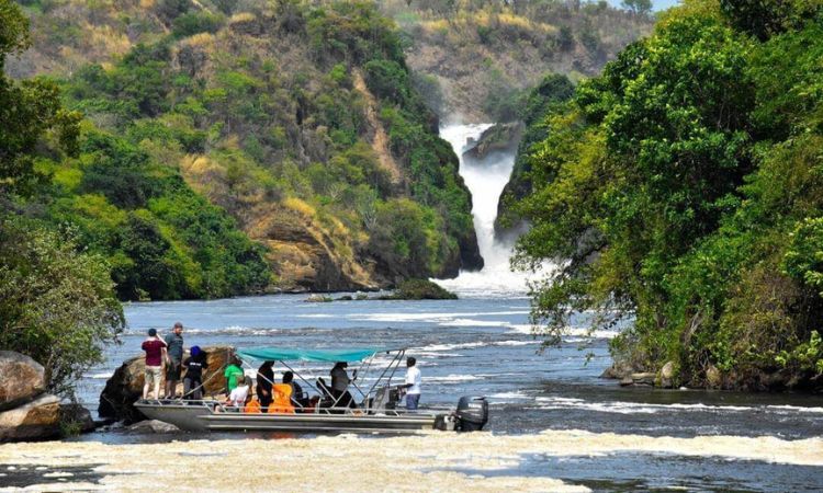
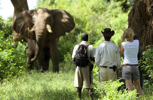
The boat cruise upstream from Paraa is the classic way to approach Murchison Falls, and for most visitors it is the most memorable. The journey covers 17 kilometers of Nile from the Paraa jetty, taking two to three hours return. As the boat moves east, the river narrows and the current picks up. Hippos surface and submerge alongside the boat. Crocodiles lie on exposed mud banks. Elephants drink at the water’s edge. Then the roar gets louder, the spray becomes visible, and the gorge opens up ahead.
The boat anchors in the pool below the falls at a position from which the full drop is visible above you. The scale is hard to process at first. The Nile, a river you have been travelling on for the past hour, comes through that gap in the rock and lands in the water around the boat in a wall of white foam. The mist from the falls settles on everything. On clear mornings, the rainbow sits directly in front of you. Boats depart from the Paraa jetty at 9:00 AM and 2:00 PM daily.
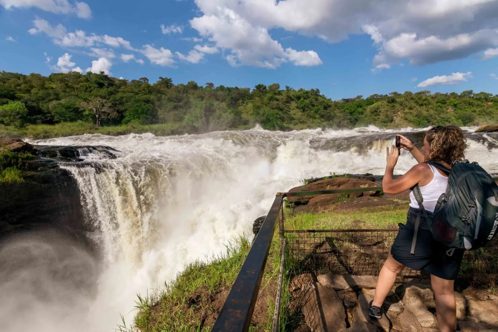
From the Top — Fajao Viewpoint
Getting to the top of the falls requires either arriving by vehicle on the Te’bito track road on the north bank, or taking the boat to Baker’s Point on the south bank and hiking up. The hike from Baker’s Point takes around 45 minutes through open forest and rolling terrain, with the sound of the falls audible throughout. The Fajao viewpoint sits directly above the gorge.
From the top, you look down into the gap itself. You see the Nile, wide and brown-green, suddenly narrow and turn white as it hits the gorge. Then it disappears into the spray below.
The scale of what is happening is easier to grasp from above than from the boat. You can see the width of the river before the falls and the width of the gap it passes through, and the difference between those two measurements tells you everything about the pressure involved. The viewpoint is railed and safe but exposed, and the edge of the gorge is not somewhere to stand without paying attention.
By Road on the North Bank
Visitors staying on the north bank or arriving through the Tangi or Wankwar gates can drive to the top of the falls directly via the Te’bito track without need to take the boat. The road runs close to the Nile and gives good views of the gorge and the upper falls as you approach. This is a quicker option for those with limited time or for a second visit to the falls on the same day as a game drive.
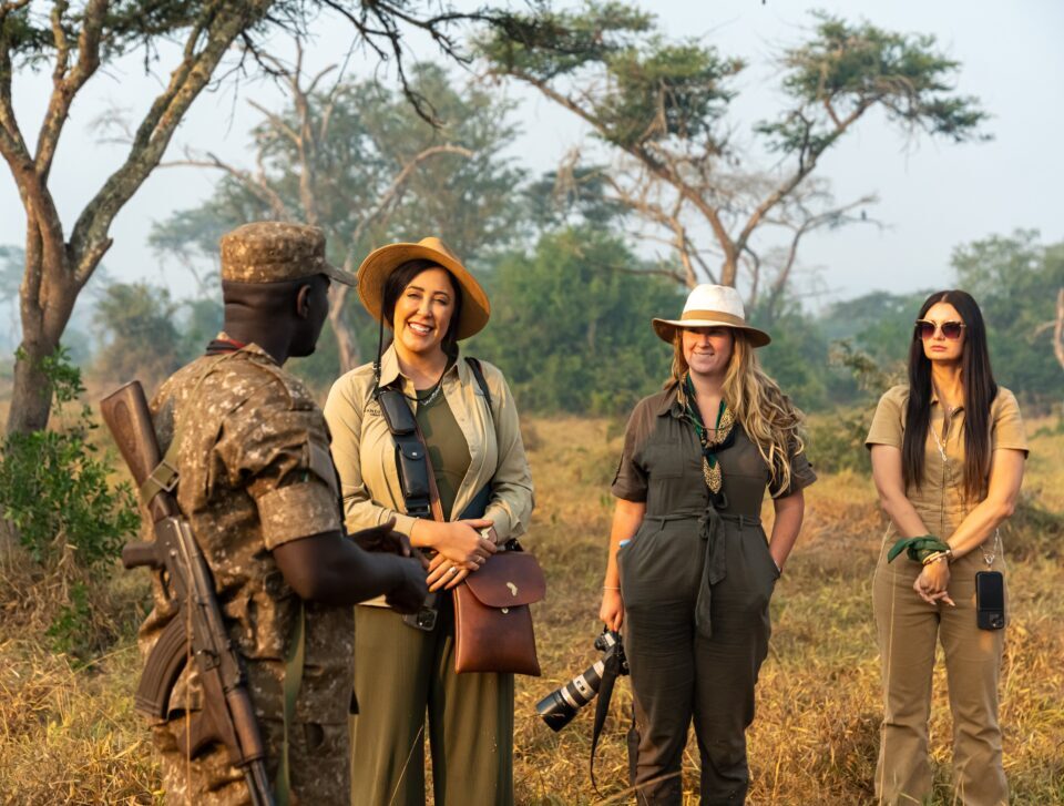
Wildlife Around the Falls
The area around Murchison Falls has some of the highest concentrations of large animals on the entire river. The churning water below the falls oxygenates the river heavily, which draws fish in large numbers and keeps the food chain active. Nile crocodiles, some of the largest in Uganda, are a constantly present in and around the pool at the base and on the rocks lining the gorge. Hippos gather in the calmer water immediately below the falls and in the shallower pools along the bank.
On the boat cruise approaching the falls, elephants are regularly seen on both banks. The Nyamusika Cliffs on the south bank above the falls are known locally as one of the better spots in the park for buffalo and for the Red-throated Bee-eaters that nest in the cliff face. Waterbucks and Uganda Kobs graze the grass near the river edge.
During dry season, when the river is the main water source in the area, the density of animals along this stretch of the Nile is among the highest you will see anywhere in Uganda.
For birdwatchers, the falls and the stretch of river below them are exceptionally productive. African fish eagles call from the trees overhanging the gorge. Pied, malachite, and giant kingfishers hunt from exposed rocks along both banks. Goliath herons stand in the shallows. African skimmers wheel in groups over the calmer water downstream.
The permanent mist from the falls supports a band of unusual vegetation along the gorge walls that in turn attracts insect-feeding species not commonly seen on the drier surrounding savannah.
Murchison Falls National Park
Best Time to Visit
The falls themselves can be visited year-round. The boat cruise to the base of the falls runs throughout the year. The dry seasons from December to February and June to September are the most popular for visiting, when the weather is more settled and the boat cruise also produces the most wildlife sightings along the river banks. In the wet season, the falls are higher and more powerful as the Nile runs at a greater volume, which can make for a more dramatic experience of the falls themselves, though the surrounding scenery is harder to navigate.
How to Get There
Murchison Falls sits within Murchison Falls National Park, approximately 305 kilometers north of Kampala. The standard road approach is via Masindi town and the Kichumbanyobo Gate in the south of the park. From the gate, the road leads north through Budongo Forest to Paraa, where the boat cruise to the falls departs. The drive from Kampala takes four to five hours.
Domestic flights from Entebbe to Pakuba Airstrip inside the park take under an hour and land visitors directly on the northern bank. The top of the falls on the north bank is accessible from the Te’bito track by road from the Paraa area, or from the south bank by hiking up after the boat drops visitors at Baker’s Point.